September 30, 2009
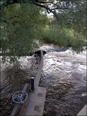
With Boulder County’s farmers markets brimming with produce this fall, it is worth noting that the intricate system of water diversions in the county helped make the bounty possible.
In fact, while nature’s handiwork is the primary force in carving the splendor that reigns over Boulder, Colo., the heavy hand of human engineering transformed the city and county dramatically.
By taming the water cascading down from the high mountains, water engineers turned the high-altitude, semi-arid desert of short-grass prairie into a lush, green urban landscape surrounded by irrigated farmland.
Nature worshippers mesmerized by Boulder’s beauty may not realize that the city’s lush neighborhoods, fields and open space are green not by nature’s hand, but by man’s.
This metamorphosis was illustrated in fine detail at an exhibit this summer at the Boulder Public Library entitled The Ditch Project. The unmistakable message of the exhibit was that the lowly, ignoble ditch was in fact was the conduit that brought wealth and greenery to Boulder.
The exhibit’s historic maps, photos, diagrams and documents of the tale of water diversions in greater Boulder and beyond illustrated the dramatic change in landscape that occurred in the last 150 years, caused by the development of irrigation ditches and reservoirs.
A summary of some of the exhibit’s historical notes as displayed at the library follows. (The Ditch Project actually spanned three venues in the spring and summer of 2009; more detailed information may be found on The Ditch Project’s Web site.
From desert to oasis
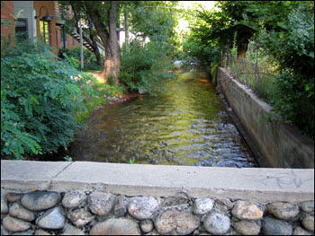
Boulder was once considered a part of the so-called Great American Desert, a phrase coined by explorer Major Stephen H. Long to describe the flat, arid and treeless area now known as the Great Plains, unsuitable in its raw state for agriculture or habitation (at least by water-needy settlers).
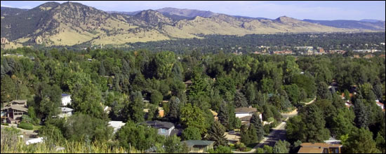
It is safe to say that Long would find the region dominated to the west by the angular 14,000-foot mountain that bears his name nearly unrecognizable.
The series of irrigation ditches and reservoirs both created new ecosystems and replaced others, bringing new plants and wildlife and ultimately the tens of thousands of residents that now reside in Boulder County.
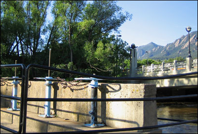
The transformation was quick. The area’s first ditches were built by and for settlers chasing gold in Gold Hill, Idaho Springs and Black Hawk. The Smith Goss Ditch was the first ditch built in 1859 and by 1864, there were 36 Boulder ditches.
It is estimated that only 13 lakes covering 9 acres were present in greater Boulder when settlers arrived — Jewel Mountain Lake being one of the few natural lakes. Today, over 1,127 acres of lakes dot the Boulder landscape, about two-thirds of which are reservoirs for irrigation and drinking water; one-third are gravel pits filled with water.
Where the only pre-1850 water impoundments in the area were due to beaver dams (beavers were wiped out by mountain men in the 1820s), Gross, Barker, Boulder, Baseline and Valmont reservoirs now store water.
Ironically, while it appears that there is more water in the area because of the numerous reservoirs, ditches and lakes, there is actually a net loss of water due to evaporation, according to the exhibit. At the same time, because ditches leak water into groundwater, this “return flow,” combined with lawn irrigation flow, has helped creeks flow more permanently throughout the year.
Flora, fauna thrive, replaced
Before large-scale water development and settlement, a few native willows and plains cottonwoods grew in the area’s riparian zones. Now, riparian zones and the plants and wildlife supported by them reach out along irrigation ditches and into fields.
Cottonwoods and willows have extended their historic range into these new riparian zones, and pasture grass, crops and ornamentals are now present, including many non-native plants (such as Russian olives) along ditches.
The subsequent increase in wetlands in greater Boulder has attracted many forms of wildlife, including Canadian geese, which were rarely spotted in the area prior to development. Coyotes, foxes and owls also now thrive here.
However, it is suspected that because ditches diverted water from creeks, native fish such as grizzard shad, longnose sucker and black bullhead may have been reduced. Other fish, such as brown trout, were introduced.
Boulder Creek transformed
Boulder Creek, the most prominent creek that bisects central Boulder, is no longer a “natural” creek, with numerous diversions reducing the many natural channels. Spring flooding, once common, is now rare.
Boulder is certainly a more habitable and prosperous place due to the ditch-digging efforts of Boulder’s 19th century settlers. However, with the knowledge that Boulder has been dramatically engineered to support large numbers of humans requiring lots of water to keep lawns green, toilets flushing and livestock well-fed, one can’t help but think something has been lost.
Not only is the natural landscape that Major Long found so many years ago lost, but also humans’ ability to live within the natural carrying capacity of the land they occupy. In fact, despite the dozens of diversions and water projects, there is still not enough water for projected population growth.
While serious rainfall this April and May was the most water from the sky since 1999 (a whopping 8.92 inches, according to the U.S. National Oceanic & Atmospheric Administration), the cycle of drought in the Rocky Mountain West dictates that the current abundance of water will soon be challenged, despite man’s clever engineering.

Story and photos by David Iler